
Photo By/Credit
USFWS
Date Shot/Created
06/26/2024Media Usage Rights/License
Public Domain
Image
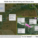
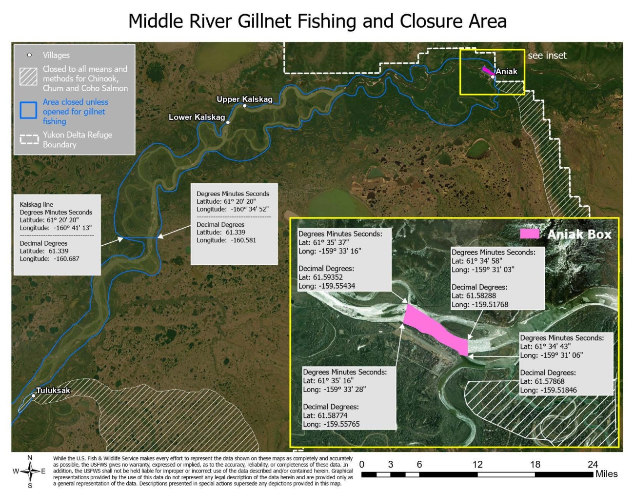
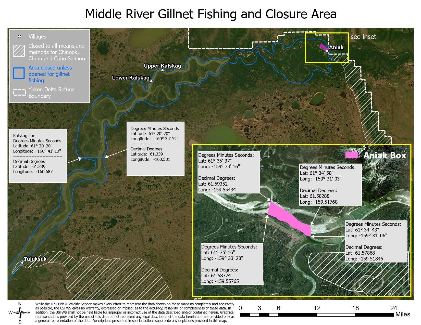
Image Description: A map of the middle Kuskokwim River from about 3 miles downriver of Tuluksak up to Aniak and down river east past Aniak. A blue line outlines areas on both sides of the river the entire length shown and says that fishing is closed unless opened for gillnet fishing from Tuluksak to Aniak. Areas stretching from the south river's east edge up to Eek and further East., and upriver from Aniak and on are closed to all means and methods for Chinook, Chum and Coho salmon. A callout Aniak Box shows the area showing the boundary: Degrees M:inutes Seconds: Lat: 61 35' 37", Long: -159, 33' 16". Decimal Degrees: Lat: 61.59352. Long: -159.55424. Lat 61, 35' 16", Long: -159, 33' 28". Decimal Degrees: Lat: 61.58774. Long: -159.55765. Lat: 61, 34, 58". Long: -159, 31, 03". Lat: 61.58288. Long: -159.51768. Lat: 61, 34, 43". Long: -159. 31', 06". Lat: 61.57868. Long: -159.51846.Text: While the U.S. Fish and Wildlife Service makes every effort to represent the data shown on these maps as completely and accurately as possible, the USFWS gives no warranty, expressed or implied, as to the accuracy, reliability, or completeness of these data. In addition, the USFWS shall not be held liable for improper or incorrect use of the data described and/or contained herein. Graphical representations provided by the use of this data do not represent any legal description of the data herein and are provided only as a general representation of the data. Descriptions presented in special actions supersede any depictions provided in this map.
Recreational Activity